| 1. |
GENERAL INFORMATION |
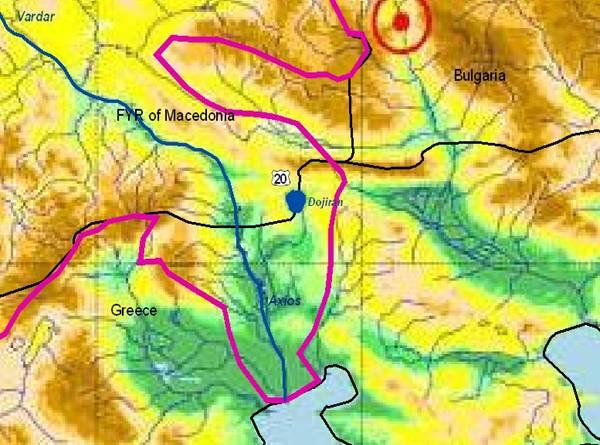
Lake DOJRAN / DOJIRANI Sub-basin
(sub-basin shared by FYR Macedonia and Greece)
|
This lake is located in south-eastern FYR Macedonia and some 100 km north of Thessaloniki (Greece) and drains into Axios (Vardar) river. It has a catchment area of 200 km²(2/3 of it in Greece), a surface area of 43 km² (FYR Macedonian part: 27.4 km²) and a maximum depth of 10 m. Over the last 20 years the lake level continuously dropped due to reduced precipitation and Greek abstractions mainly for irrigation (the water volume receded from 262 million m³ in the 1950ies to 95 million m³ in 2000 and only 65 million m³ in 2002). This region has the highest average annual temperatures of FYR Macedonia and is also a socio-economic and ecological crisis area, due to the effects from climate change and human activities.
|
FYR MACEDONIA |
GREECE |
1.1. Geographical properties |
Longitude/latitude at downstream river outlet |
41°23‘N 22°45‘E |
between 41° 10’ 24’’– 41° 15’ N and 22° 42’ 45’’ – 22° 47’ 18’’ E. |
Size of basin |
271.8 km² (179.7 km² in Greece, 92.1 km² in FYR Macedonia) |
Length and width in km |
The maximum length of the lake is 8.9 km and the maximum width is 7.1 km. For these data the water surface of the lake is 42,5 km², and in 2000 it was 32,5 km². |
Topography, including altitude range in m |
148 m a. s. l.
A relatively small part of the catchment, around 50 km2 or 18%, is at an altitude higher than 500 m.
The surface area of the catchment does not increase significantly with the lowering of the altitude. This shows that the surface areas have high slopes and form conditions for drainage of the surface waters. This especially concerns the southern side of Belasica Mountain. |
Geology |
The Dojran Lake is located on the boundary of two blocks (Metamorphic rocks and Vardar zone). The boundary between the two massifs lies along the eastern and northeastern part of Lake Dojran and was formed in a karstified basin created by a combination of Tertiary volcanic and tectonic activity. |
Metamorphic rocks (amphibolite, gneiss, and schist with intercalations of marble) are dominant in the area. Mesozoic granite, granodio-rite, and monzonite are minor in extent. Tecto-nic sediments of Pleistocene age (clay, sand, conglomerate, red clayey material, etc.) as well as Holocene alluvial deposits are found in the valley.
The wider surroundings of the lake belong to the Serbo-macedonian massif of the Vertiskos series. |
Rainfall, average annual and seasonal distribution, etc. |
- The annual precipitation varies from 600 to 680 mm for the wider catchment area.
- Sunny, dry and hot summer periods and not so cold and dark winters.
- Regarding the hydrological classification the region can be classified as semiarid.
- Average annual air temperature is 14.1° C. Hottest month is July with mean 24.6° C and coldest month is January with 3.4° C.
- In summer months in Dojran the relative humidity is 57% - 59% and in winter 75% - 81% (average 71%).
- Evaporation from free water surface vary from 1,050 mm/y up to over 1,400 mm/y
|
- The mean annual temperature is 14.11° C, and the mean annual precipitation is 596.5 mm.
- ‘Humid’ climate: very hot summers, mild winters, and humid seasons. The lower areas around the meteorological station belong to the semihumid bioclimatic floor with a cold winter
|
River(s), with lengths and average annual flows and seasonal distribution - flood and drought incidence and impact |
Area of the lake: 42,66 km² (25,6km² in FYR Macedonia, 17.06 km² in Greece).
The river network in the catchment within the territory of FYR Macedonia is poorly developed. |
1.2. Demographic properties |
FYR MACEDONIA |
GREECE |
General location of the basin |
Dojran Lake is situated on the Balkan peninsula in south-eastern Europe. The state border between FYR Macedonia and Greece divides both the catchment area and the lake itself. Dojran Lake basin belongs to the Aegean Sea Basin, as part of the wider river Vardar catchment. |
Lake Doirani is situated in northern Greece at the south-western end of a valley between the Beles (Kerkini) Mts. and Kroussia (Dysoron) Mts. The lake is crossed from north to south by the state border between Greece and FYR Macedonia |
Total population in basin |
According to the last census (2002) in the municipality of Star Dojran (with the cities Star Dojran, Nov Dojran and the village of Sretenovo) the total population is 3,472 inh (1,021 households)
(population data refer to the territory of municipallities but not to the catchment) |
? |
Population of principal cities or towns |
Principal cities are Star Dojran and Nov Dojran |
? |
Average per capita income |
? |
? |
Industrial and agricultural GDP (Gross Domestic Product) (2003) |
? |
? |
Population living below the poverty line |
? |
? |
Other relevant characteristics |
? |
? |
1.3 LAND USES |
? |
? |
2. WATER RESOURCES / USES AND ENVIRONMENT SITUATION |
FYR MACEDONIA |
GREECE |
Total available surface and groundwater resources |
The total annual groundwater recharge on the FYR Macedonian part of the catchment is estimated at 5,7 million m³. |
The lake is fed by small streams which often dry up completely in late summer, and by several springs. There is only one outlet, a channel on the southern Greek shore, which transfers water to the Axios (Vardar) River. |
Net usable capacity of surface reservoirs |
? |
? |
Total surface water abstractions (estimated where not measured) |
No surface water abstractions exist on the FYR Macedonian side. |
|
Total groundwater abstractions (estimated where not measured) |
Total groundwater abstraction is 50% (2.84 million m³) |
? |
Surface and groundwater quality (in general categories only) |
- high alkalinity (pH between 9,2 and 9,6)
- elevated Carbonate and Magnesium hard-ness (total hardness about 330 mg/l as CaCO3)
- toxic substances, which are near or even beyond toxic levels, COD is close or just exceeding to accepted levels for freshwater standards of 90 mg/l, electrical conductivity, iron values and dissolved oxygen are above the accepted levels.
|
Surface water quality: high values of phosphates, conductivity and arsenic |
Water uses (total, by sector, principal uses, current (estimated) and future (projected), include in-stream uses (fisheries, etc.) where appropriate) |
The lake is important for the populations’ subsistence – tourism & fishing were leading economic activities in the past. |
Water is abstracted from the streams flowing into Lake Dojran and the aqui-fers on their territory around Dojran, mainly for irrigation. |
Deficits and other resource concerns (e.g. quality, extremes, environmental degradation) |
- A rough assessment on the annual water balance reads tentatively: while the total recharge (ground-water and surface inflows) amounts to about 30 million m³, and water use plus net evaporation from the lake amounts to 40 million, the mean annual water balance amounts to a deficit of 10 million m³.
- Orthophosphate-phosphorus concentrations are above standard values for lakes and reservoirs, thus indicating a eutrophic system
- Due to the high amount of phytoplankton, there is always the danger that over night oxygen is reduced to 25% saturation or less, thus resulting in oxygen stress to aquatic life
|
The numerous flood beds and ravines testify an intensive state of erosion in the past.
The water level is dependent mainly on rainfall, fluctuations of the outlet, use of water for irrigation, and intensive evaporation during summer. The lake level starts to rise in autumn and reaches its maximum in spring. |
ENVIRONMENTAL PROPERTIES |
Sensitive ecosystems, biodiversity and environmental impacts in the basin |
- The decrease of water and the simultaneous deterio-ration of the water quality had serious ecological impacts. The ecological decline had a harmful im-pact on the economic activities of the local popula-tion living in the Dojran Municipality of Rep. MAK.
- As a result of the complete deterioration of the conditions of Dojran Lake, the effects have been negatively manifested on the biodiversity of the lake.
- Production of food for the lake fauna has rapidly decreased which resulted in the decrease of all fish species in the lake and caused large-scale migration of greater number of bird groups.
- For the FYR Macedonian side, no special data are available on vegetation, except that the forests are of rather poor state.
|
- Lake Doiran was included in the Inventory of Greek Wetlands as Natural Resources (Zalidis, 1995). The Greek National Strategy for Wetland Resources can be found at the website of the Ramsar Convention.
- Pollution: Municipal wastewater, municipal solid wastes, sewage from tourist facilities, agricultural point source and non-point source pollution, transboundary pollution.
Other anthropogenic activities: Overfishing, illegal or non-sustai-nable hunting
- The “Aquatic Forest of Mouria has been listed as a "Natural Monu-ment” and also proposed, together with a small part of the lake (200 ha), for inclusion in the EU NATURA 2000 network.
|
3. BASELINE INFORMATION AVAILABILITY |
FYR MACEDONIA |
GREECE |
Observation networks |
- Observation networks exist - water level gauge for lake surface water level.
- Several rain gauges exist in the catchment. The monitoring however is not regular, resulting in data gaps in the last years (automatic meteorological stations in Mrdaja and in Star Dojran)
- Groundwater monitoring is limited to existing wells and previously undertaken groundwater investiga-tions. Irregular monitoring (piezometers) of ground-water exists at the moment on FYR Macedonian side.
|
The nearest meteorological station on Greek territory is in Metaxochori (277 m asl.), 24.5 km southeast of the village of Mouries. The complete set of data from the station covers 11 yrs (1965–67, 1975–76, 1980, 1982–85 and 1985). |
Maps, with available scales, GIS and remote sensing imagery |
Topographical maps: 1: 25,000; 1:50,000 (+ GIS DTM from maps 1:25,000)
Geological maps: 1:200,000
Hydrogeological maps: 1:200,000 (in prepar. 1:25,000)
Agricultural land-cadastral plans: 1:5,000
Urban area plans: 1: 2,500, 1:1,000 |
|
Data archives and their adequacy |
- No permanent measurement of surface water streams exist. Data are limited to short term studies.
- Monitoring data for all major meteorological para-meters and water level exist from 1961.
- Data archives exist in relevant governmental institu-tions and research institutes, Ministry of Environ-ment, Administration for Hydro-meteorological Works within the Ministry of Agriculture, Forestry and Water Economy, Municipality of Star Dojran.
|
|
Research centres |
Responsible institution for hydro-meteorological observation and monitoring is the Hydro-meteorological Service (HS) under the Ministry of Agriculture, Forestry and Water Economy.
For water quality and environmental issues the responsible institutions are: Ministry of Environment and Physical Planning and Hydrobiological Institute-Ohrid. |
EKBY (Greek Biotope/Wetland Centre)
AUTH (Aristotle University of Thessaloniki) |
NAME AND CONTACT DETAILS OF PERSON(S) COMPLETING THIS FORM |
Prof. Cvetanka Popovska, PhD
University of Ss. Cyril and Methodius, Fac. of Civil Engin.
Partuzanski odredi bb, PO Box 560, 1000 Skopje, FYR Macedonia
Tel: +389(2) 3116066/ext. 209; Fax: +389 (2) 3117367
e-mail: popovska@gf.ukim.edu.mk
Vladimir Stavric, MSc
Ministry of Environment and Physical Planning, UNDP, NCSA Project Manager
Tel: +389(2) 3061665; e-mail: vstavric@mt.net.mk |
Prof. Jacques GANOULIS
Hydraulics Laboratory
Civil Engineering Department
Aristotle University of Thessaloniki
54124 Thessaloniki, Greece
Tel: +30-231-099.56.82
Fax: +30-231-099.56.81
e-mail: iganouli@civil.auth.gr |
FYR Macedonia |
Greece |
4. MANAGEMENT SETTING |
4.1. International agreements / conventions and national legislation |
An agreement on maximum and minimum levels of Lake Dojran made in 1956 has become ineffective by the lake level falling below the controlling outfall structure for unsubstantiated reasons.
The most recent meetings have been at government level (July 2002) and at technical level (September 2003). Although agreeing on exchange of information, integrated studies, and working towards establishment of a Joint Water Management Commission, these agreements have not resulted in active cooperation in river basin planning or management of Doirani Lake.
The lake is bound to the Convention for protection and use of the transboundary watercourses and the international lakes (1992; not ratified by Rep. Mac. yet) and the Espoo Convention. |
For this information please see the MAK section in chapter 3.11
National legislation and documents:
- Law on the Protection of the Ohrid, Prespa and Dojran lakes, The Official Gazette of RM, No. 45/77
|
Regulation on threshold values for harmful substances in effluents, game refuge (part of the wetland).
Reference in International-European biotopes/wetlands catalogues (Impor-tant Bird Area ICBP-IWRB, CORINE Biotopes), establishment of wastewater treatment facilities, Chemical studies, Ecological studies.
It is expected that the new law in Hellas (L3199/03), which activates the EU-WFD, should regulate all necessary action for the management of the lake. |
4.2. Institutions / distribution of responsibilities |
For this information please see the MAK section in chapter 3.11
Public Enterprise DOJRANSKO EZERO (management of the Hydro-system for Recharge of Dojran Lake from Gjavato Wells- project implemented in 2003) |
All lakes in Greece are under the responsibility of several authorities. Distribution of responsibilities follows a sectorian policy with very limited coordination.
At national level, the Ministry of Environment, the Ministry of Agriculture and the Ministry of Economics are respon-sible. For transboundary lakes the Ministry of Foreign Affairs is also involved.
To some extend all local authorities have a role. These authorities are responsible for water quantity and quality management. |
4.3. Planning / Decision making processes |
Joint transboundary planning and decision-making in the basin is poor, although considerable efforts on problem definition are undertaken. In 2000-2001 UNESCO and the Ministry of Environment and Physical Planning have supported and realized a Feasiblity Study on Rehabilitating Lake Dojran Lake Salvation. Within the UNESCO Program in the period 2002-2003 a project titled: “Sustainable Management in Dojran Lake Catchment - Campaign for Rehabilitating Lake Dojran”, was executed. |
The lake in Greek side is designated as NATURA 2000 site, so all planning and decision-making is carried out according to the provisions of the relevant national and EU legislation.
The main question on effective bilateral cooperation remains unresolved. |
4.4. Finances |
A management of the Dojran Lake ecosystem does not exist. Up to now financial resources have been mobilized on monitoring and water recharge from the wells system in Gjavato (mainly from the national budget). The major financial resources in the past were:
- UNESCO, via the National Commission for Macedo-nia in cooperation with the National Committees on Hydrology and Geology
- Ministry of Agriculture, Forestry and Water Economy
- Ministry of Environment and Physical Planning
- Fund for Waters
- Public Enterprise for Water Management
|
All management activities related to the lake are funded by the national government (DAC-OECD) and EU resources (e.g. INTEREG III, PHARE etc) |
4.5. Past and present major projects (including listing of donor interests) |
- Improvement of monitoring system of Dojran Lake (finances provided from UNESCO program). Within this project one automatic meteorological station in Mrdaja was established. In operation since 1996, operated by the Hydrometeorolog. Service.
- Restoration of Dojran Lake. Project started in 1997 and finished in 1999. Total funding was provided from the Ministry of Science, the Ministry of Culture and the British Embassy (10,000 pounds). Contract No. 08-3580/2 with the Ministry of Science.
- Expertise on the state of biodiversity in Dojran Lake (UNESCO Participation Program). Executed in 2001.
- Comparative Chemical Analysis of the Waters of Lake Dojran and Gjavato Well No. 1. Project supported by the Ministry of Environment and Physical Planning (national budget). Project time execution September-October 2001. Contract No.04-2871/1.
- Expertise on the Condition of Biodiversity of Lake Dojran. Project supported by the Ministry of Environment and Physical Planning (national budget). Project time execution August-Nov. 2001.
- Recharge of Dojran Lake from Gjavato wells- Dojran Lake Salvation Project. The total funding is 25 million DM provided from the National Budget (Ministry of Agriculture, Forestry and Water Economy, Fund of Waters, Ministry of Environment and Physical Planning). Executed in 2001. The constructed Hydro-system Gjavato is in operation since 2003.
- Dojran Lake Conservation. Project started in 2001 and finished in 2002. The total funding is 22,000 US$ (UNESCO Participation Program, Contract UNES0001).
|
- GTZ: Assistance to the Water Resources Management, providing long-term though low intensity assistance to the MAFWE. The most relevant output to this project has been the summary report on the water balance of Lake Dojran.
- Government of FYR Macedonia: Development of the Gavato Scheme to pump groundwater from the Vardar valley to Lake Dojran. The scheme has been operating for several years and has contributed to increased water levels in the Dojran Lake. However, high operating costs make the long-term operation of the scheme uncertain.
- The project: “Assessment of the degree of expression of the functions and values of the transboundary Lake Doiran” contr. no. ANAP – 08 – 2003) is funded by the Ministry of Foreign Affairs – HELLENIC AID and carried out by the Goulandris Natural History Museum – Greek Biotope/Wetland Centre, Thessaloniki
|
4.6. Stakeholder Participation |
The biggest stakeholders in the region are the Local Self Governments, the tourism business/companies and the farmers. NGO’s are also engaged in actions protecting the environmental uniqueness of the lake. |
Although local authorities made a great effort in the past, stakeholder participation remain very weak, as never it was one of the priorities. |
4.7. Awareness / Communication |
Since ancient times Dojran Lake and its surrounding area are well known for their scenic beauty. Over the last two decades this natural heritage became vitally threatened because the lake’s water declined seriously. The local awareness about the impacts of high water use in the catchment and the communication with the Greek side is very poor. The economic development in the region (especially domestic tourism) has stopped completely. |
Α natural history museum is under construction. |
FYR Macedonia |
Greece |
5. CONCLUSIONS / RECOMMENDATIONS |
5.1. Identification of critical problems (transboundary situation)
- problems related to the resource
- problems associated to uses, needs and demands
- problems affecting ecosystems |
The critical problems regarding Dojran Lake can be related to the deteriorated hydrological conditions of the last decade: Out of a total volume of 262 million m³, the volume diminished to only 65-95 million m³ in 2001-2003 (long draught, intensive evaporation from the lake that was greater than the precipitation).
Other problems are the uncontrolled drainage within the catchment (2/3 on Greek side), the missing efforts for concrete political cooperation on both sides and finally to the low awareness about the impacts for the ecosystem. |
- Excess goundwater pumping
- Agricultural mismanagement
- Wastewater and solid pollutants from residential areas
- Untreated wastewater discharges from FYROM hotels.
- Non-point pollution from agricultural land.
- Illegal hunting
|
5.2. Main achievements |
- Establishment of monitoring stations
- Improvement of water discharge in the lake
|
Local studies and problem definition |
5.3. Key challenges |
- Bilateral agreement
- Start rehabilitating projects with the Greek side (to improve the natural surface and groundwater draiage from the catchment with the biggest part being on Greek side, that will decrease the evaporation rate and restore the water balance of the lake)
- Establish transboundary cooperation.
- Build capacity on systemic, institutional and personal level on both sides
- Involve local communities
- Search and mobilize all kinds of capital.
- Build a strategy for stakeholder participation
|
- Effective monitoring
- Water balances
- Modelling water quantity and quality
- An integrated approach of all envi-ronmental, political, social, economic and technical aspects of water resources management is needed in order to ensure water preservation and environmental integrity of the region.
- Wetland functional analysis.
- Wetland function's socio-economic evaluation.
- Stakeholder engagement.
- Implementation of the EU- WFD.
|
5.4. Donor interests |
Overall ability to mobilize domestic and private capital is poor. International and bilateral donors do not show interest for saving the lake and its ecosystem. However, no major projects have been implemented yet. A main reason for this is the lack of bilateral agreements between Greece and FYR Macedonia. |
Different International donors, like GTZ have been interested in the past. |
5.5. Recommended priority actions |
Although a FYR Macedonian-Greek Commission between the responsible ministries was established in the past, it is not active at the moment. Regarding environmental protection of the Dojran Lake, there is still much to do about management development on both sides. The recommended priority actions are:
- Identification of causes for the water volume decrease
- Identification of causes for losses in flora and fauna
- Improvement of the hydrological and water quality monitoring on the both sides
- Water supply in the region
|
- Water supply regulation on both sides.
- Cease of dumping on FYROM side and wastewater treatment in the nearby urban areas.
- Creation of an early-warning system for sudden pollution.
- Creation of a data logger network for monitoring water quality.
|
6. MAIN REFERENCES, BACKGROUND DOCUMENTS |
Recharge of Dojran Lake from Wells System in Gjavato: Project for salvation of Dojran Lake, Government of the FYR Macedonia, 2001 |
- NATURA 2000 national database
- Greek Biotope/Wetland Centre records
- International Workshop on Integra-ted Management and Protection of Transboundary rivers and wetlands, Wetlands International, 24-26 June 1999, Wagenigen, NL
|
Physical Plan of the Republic of FYR Macedonia: Public Enterprise for Spatial Planning, 1998 (revised 2004) |
National Development Strategy:
Academy of Sciences and Arts of FYR Macedonia, 1997 |
National Environment Acton Plan: Ministry of Environ-ment and Physical Planning, 1997 (in revision) |
|